Ali Shiraef

English 1103H

Category: Major Projects (page 3 of 4)

Undeveloped Southside Beltline Trail (BED 3, Artifact 7)

img_4616 img_4614 img_4612 img_4609 img_4607 img_4605

The Kudzu. There was so much of it! I had never seen as much kudzu in my entire life living in Georgia than I did on this day. I wondered, as I tried my hardest to picture a concrete trail running through this area, if any of the kudzu would be left behind after the construction. After all, the giant mounds and figures of kudzu in the images wouldn’t necessarily be in the way of the trail. Some Georgians, however, despise the site of kudzu. Perhaps the plant would be demolished due to its appearance and growth ability alone.

Undeveloped Southside Beltline Trail (BED 3, Artifact 6)

img_4598 img_4596

One problem I had when I explored the partially developed Eastside Trail was how it was extremely difficult to access. I had a hard time finding the trail itself, and the public parking I was forced to pay for was a long distance from the trail’s entrance. This trail, while significantly less developed than the one I covered in my first Built Environment Description, was nearly impossible to find access to. The images above show some of my classmates finding difficulty in hiking up what appeared to be a rain outlet in order to get to the trail. The stone pillar on the left of the first image was the beginning of the bridge in my 5th artifact. I think it will be interesting to see what decisions the Beltline makes regarding entryways and access points.

Undeveloped Southside Beltline Trail (BED 3, Artifact 5)

img_4600 img_4593 img_4591

The above pictures show a beautiful old bridge that was the beginning of my hike down the Southside Trail. The bridge has its own set of graffiti art, and its past is unknown to all passerby. It once served as the sturdy bridge for a very important railroad circling Atlanta: the beltline corridor. With the plans in place to establish public transit on the Beltline, I wondered if historic bridges such as this one would need to be replaced to fit a walking trail along with light rail.

Undeveloped Southside Beltline Trail (BED 3, Artifact 4)

img_4628 img_4623 img_4621

One of the most politically and economically appealing aspects of the Beltline project is its urban reuse and renewal. The images above show how the historic, circular railway that the Beltline follows still exists today in this section. Some parts of the rail were more exposed; other parts were nearly impossible to see under the kudzu and various weeds. As someone who loves historical sites, this part of my built environment expeditions was one of my favorites.

Undeveloped Southside Beltline Trail (BED 3, Artifact 3)

img_4626 img_4618 img_4617

As my hike continued, I notice several humungous pieces of untouched infrastructure. Power lines and utility poles ran everywhere, along with a random, untouched slab of concrete in the first image. The spaces in between all of these objects consisted of incredible amounts of kudzu. As someone observing the space with the idea of the Beltline in mind, I could not help but wonder how these spaces would be used. I also wondered just how much money it would take to replenish an area such as this one into a culturally significant trail.

Undeveloped Southside Beltline Trail (BED 3, Artifact 2)

clip23 clip22 clip21

The above sounds and visuals help better capture the overgrowth of the Southside Beltline Trail. On the Beltline’s website, this trail is considered an “interim hiking trail”, which I suppose with a broad definition, is accurate. The leaves crunching beneath our feet, the constant grabbing of thorns and weeds at our ankles and pants, the incessant biting of insects: this walk was not a leisurely one like the walks that may be taken on the developed parts of the Beltline. The politics behind the Beltline project are largely to blame for the slow process of its construction. A huge project like this one obviously needs a great amount of funds to clear out an overgrown space such as the one observed here.

Built Environment Analysis (First Draft)

https://goo.gl/images/OpCFyt

After conducting the research that I have for this class regarding the Beltline, I have discovered that many of the subjects people discuss regarding the urban design project revolve around gentrification and rising costs of living. I would like to argue that a project like the Beltline is innovative in the way that it adapts urban renewal and attempts to improve the quality of life in the neighborhoods of Atlanta. The ideas that motivated the creation of the Beltline, as provided by its inventor Ryan Gravel, introduce a modern concept to the idea of the city. It has the potential to transform Atlanta, but especially to inspire urban designers to think differently in regards to how to improve the quality of living city dwellers face in their daily lives.


So What is the Beltline?

The Atlanta Beltline, according to their website, is “the most comprehensive transportation and economic development effort ever undertaken in the City of Atlanta and among the largest, most wide-ranging urban redevelopment programs currently underway in the United States. The Atlanta BeltLine is a sustainable redevelopment project that will provide a network of public parks, multi-use trails and transit along a historic 22-mile railroad corridor circling downtown and connecting many neighborhoods directly to each other.” Some people have found this to be a long description of a glorified sidewalk. Others have realized the intentions of the Beltline, and strongly support its construction. Neighborhood activists around Atlanta continuously chip in on the effort to expand and fund the Atlanta Beltline. In the beginning of Ryan Gravel’s book “Where We Want to Live”, he details the cultural and social expectations of a project like the Beltline. He explains how living in a pedestrian and bike friendly city changes the way people interact and live with one another. I believe these ideas are revolutionary in the genre of urban design and renewal. The transformation of a now outdated and overgrown rail system to an accessible, useful, and modern pedestrian trail meant for thousands of Atlantan citizens should be considered nothing less than innovative.


What has the Beltline Accomplished so Far?

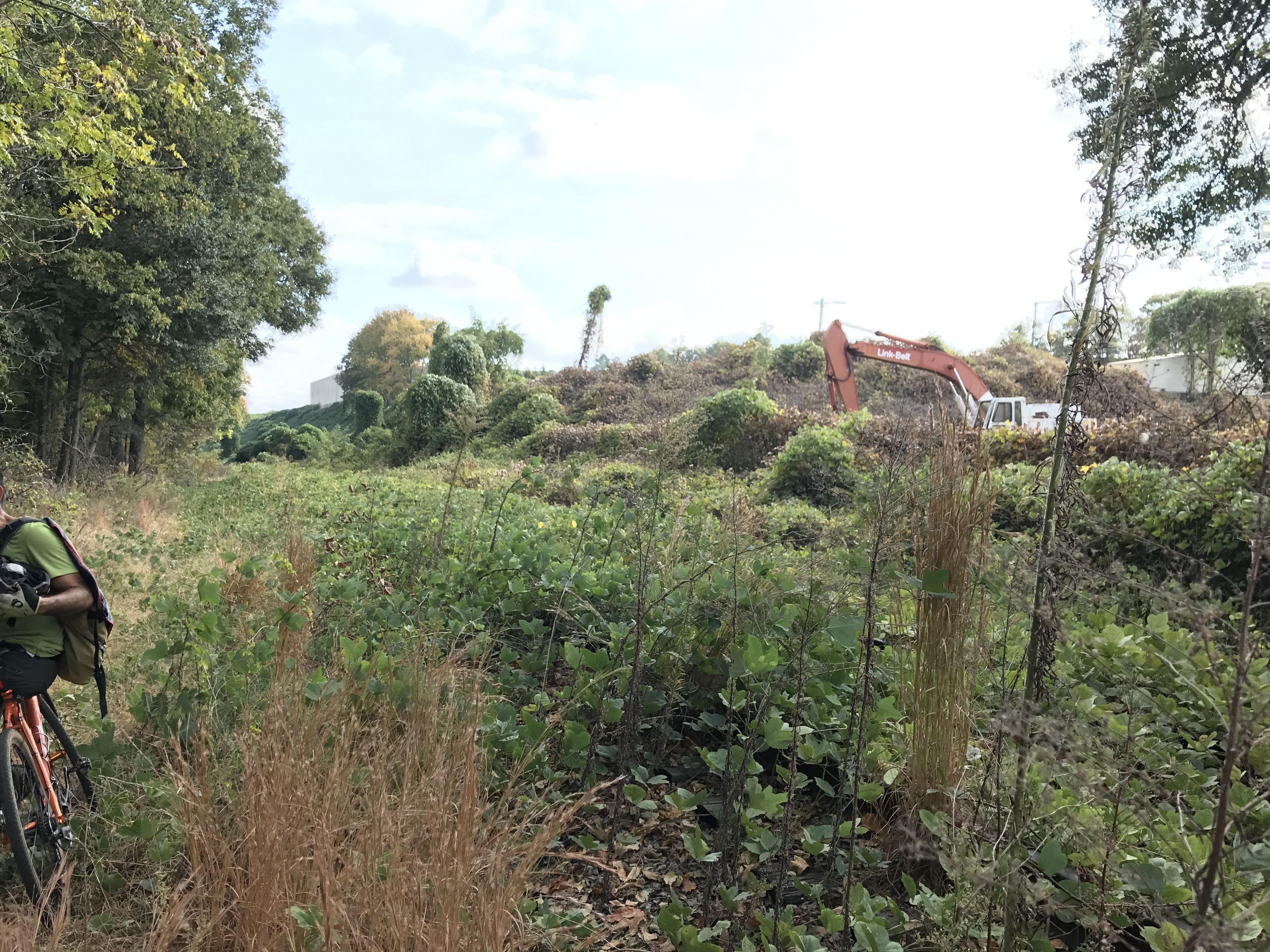
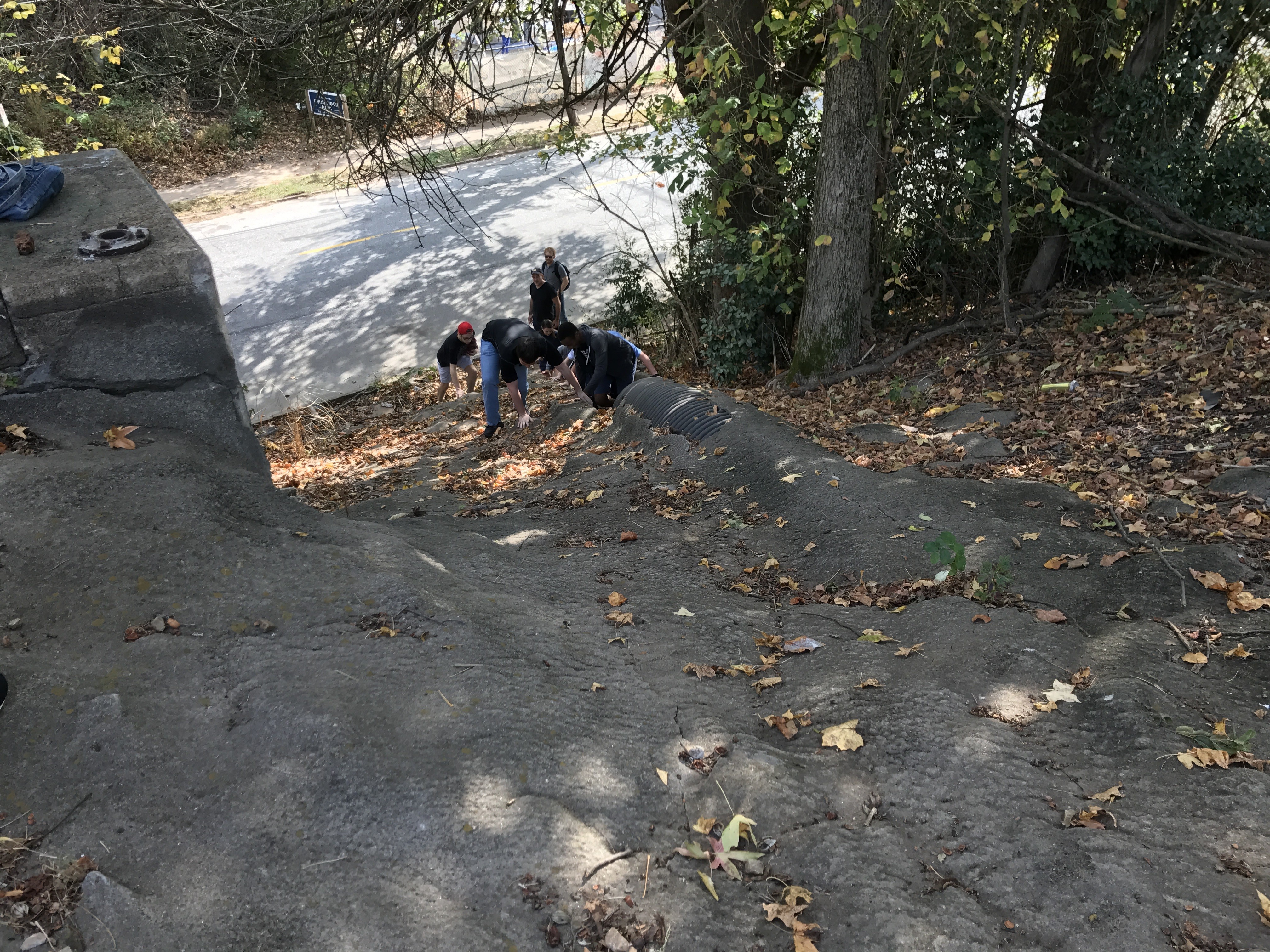
Currently, 11 miles of the proposed 22 are up and running. Several parks have already been connected to the Beltline, such as Perkerson, D.H. Stanton, Boulevard Crossing, and Historic Fourth Ward Parks. Businesses such as those that exist in Krog Street Market and Ponce City Market have been able to prosper thanks to the open access the Beltline provides. Many new restaurants and apartment complexes have begun to pop up along the trail as well. The popularity of the trail can be measured clearly by simply visiting any of the completed trails on a pretty day on the weekend. The Beltline has effectively initiated urban renewal and reuse so far with the usage of the old railways as well as projects like the Historic Fourth Ward Park which created a storm water basin/recreational park as a dual-use green space.


What will the Beltline accomplish?

The Beltline’s long term goals are of course to completely finish the trail itself around the entire 22-mile corridor, but also to establish public transit along the trail. There is an act on the November ballot for Fulton County that would better fund all transportation projects in Atlanta, including the Beltline. This funding would go toward clearing out the areas of overgrowth that currently exist on some untouched sections of the Beltline, as well as clearing the path for an eventual transit system. The Beltline also aims to extend and create new parks and green space around Atlanta.

https://goo.gl/images/AxVuJj

While the parks and the trails are a direct and obvious goal of the construction of the Beltline, another goal to consider, as desired by its creator, Ryan Gravel, is affordable housing along the Beltline. As citizens of Atlanta continue to use the Beltline and prove its worth, housing costs will rise. It is up to Atlanta’s government, citizens, and Beltline participants to effectively establish affordable housing along this multi-use trail. In Gravel’s book, he talked about how pedestrian friendly cities create an environment where people of all different backgrounds and personalities can coexist and interact effortlessly. He wanted the same to occur with the Beltline, but without the extreme efforts of the Beltline officials and possibly government intervention, gentrification will occur, and the Beltline will be mostly excluded to the upper-middle class. This is a problem the Beltline must face as it continues to establish its presence in the city.


What’s the point of the Beltline? 

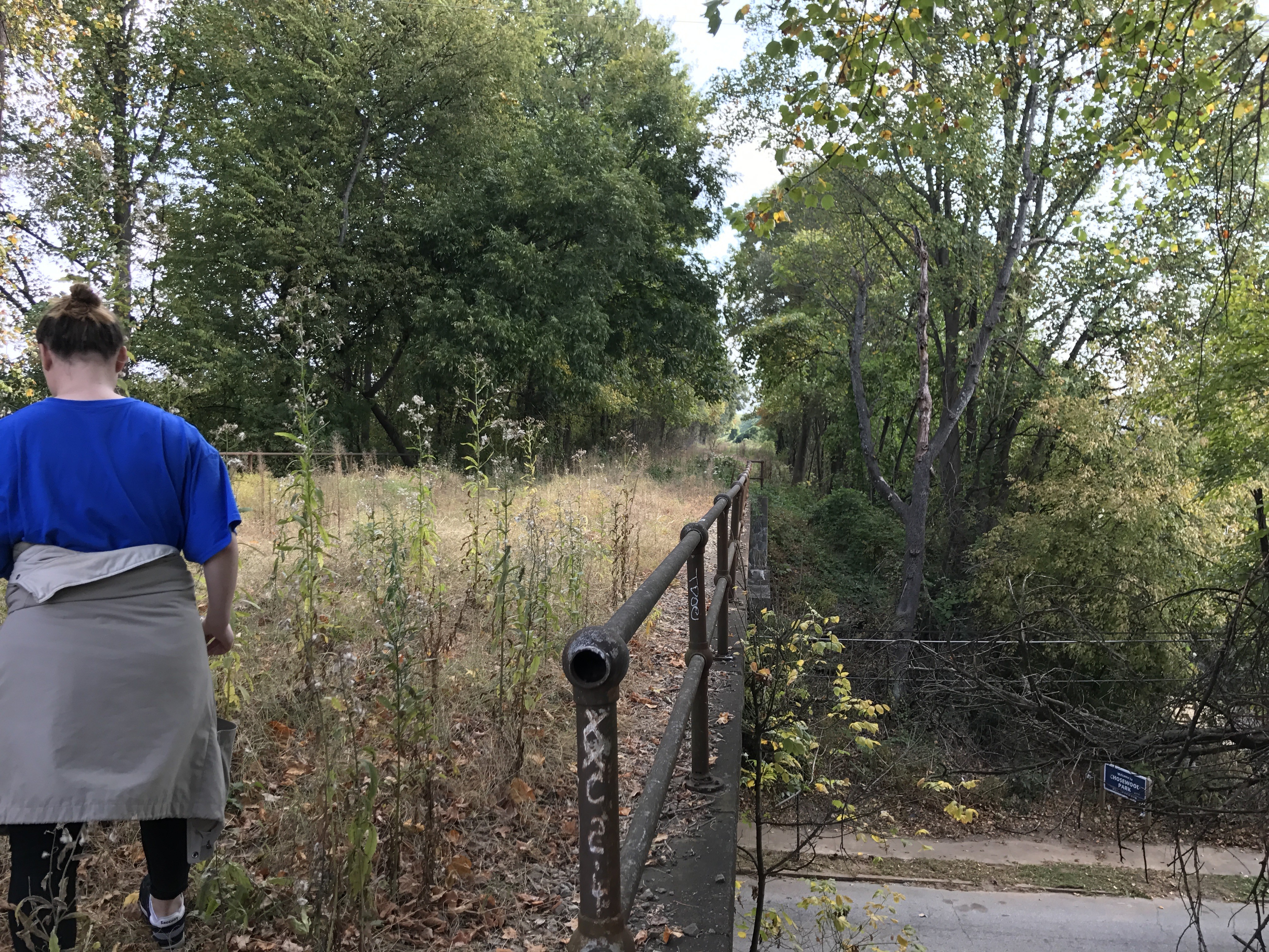
While literally and technically, the Beltline is just a sidewalk, the effects of this project have already proven to be huge in the city, and will continue to grow. Just the simple concept of a connected city has been lost in Atlanta since the ending of the streetcar system. Public transit currently doesn’t exist in Atlanta outside of the tiny loop of downtown that the “Atlanta Streetcar” covers (which is a distance I can easily walk). The Beltline, for someone like me, provides an easy and safe way for me to travel to places I like, such as Ponce City Market, Old Fourth Ward Park, and Krog Street Market. These places are cool to a young person like me, and are not only attractive to people like me, but to the city itself. Atlanta lacks the “feel” and “flavor” that some cities may be described as having. When you think of New York City, Chicago, Los Angeles, Seattle, Austin, or Boston, it’s easy for most people to describe the cities and their personality as places. Atlanta excludes itself from this concept. Urban design projects like the Beltline encourage a personality to finally attach itself to the city.

Not only would the Beltline be good for the city itself, but for its people. I have now walked the Beltline multiple times this semester, and have already felt a better connection to my city. While I know there is much more to Atlanta than the downtown campus of Georgia State and the areas of the Beltline, I believe I have experienced more of the city than many of the people that live here.

Atlanta has significantly less green space than many of the cities like it, and this project will increase the amount it has by 40%.

Undeveloped Southside Beltline Trail (BED 3, Artifact 1)

img_4594

The Southside Beltline Trail, which has yet to be developed on any level, was a fascinating sight to see. Kudzu and weeds alike surround the entire area. Despite the vast overgrowth that exists, a trail was clearly engrained in the soil from numerous adventurers’ feet. The trail was not easy to walk due to the intense plant life growing over it and around it, however this definitely added to the experience. Hikers beware: pants are necessary to travel this path. Thorns and insects thrive in this environment, as many of my classmates experienced. The railroad itself is barely visible under the massive growth in this area, which contrasts greatly from the mostly developed parts of the Beltline Trail. The potential for this site is unimaginable, yet very possible. To think that the completed Eastside Beltline Trail came from a site much like this one is nothing less than incredible.

Annotated Bibliography (Source 6)

Epsten, Dagmar B., and M. Arch. “INNER-RING SUSTAINABLE URBAN REGENERATION, ATLANTA, GEORGIA, USA.”

Dagmar Epsten writes about three specific downtown locations in Atlanta that have achieved certification under LEED, Leadership in Energy and Environmental Design. She describes the locations to be within the “inner-city ring” of Atlanta that contains low-to-medium density of population.

She introduces the paper with a detailed description of the factors of Atlanta’s urban sprawl, which is the largest in the entire nation. Dagmar uses this introduction of sprawl to establish the idea of developments that present an alternative to urban sprawl.

The three examples used in the paper include Atlantic Station, Technology Square at Georgia Tech, and Edgewood Offices. For each, Dagmar describes the location, density, transportation, and urban environmental benefits.

Toward the end of the paper, Dagmar discusses the utilization of “inner-ring development” in Atlanta. She describes how the trend of the past several years has been to redevelop these areas to create more sustainable development. Here, she begins to write about the Beltline, and how the project connects the “underutilized areas” in the inner ring. Dagmar says the Beltline “would also likely contribute to transportation and density goals for developments in its proximity which like the projects presented in this paper, might aspire to be examples of sustainable development and perhaps also pursue LEED objectives”.

Dagmar Epsten was the president of The Epsten Group Inc., a sustainable building design firm located in Atlanta. She received her education at Georgia Tech and is currently employed there as a lecturer in the College of Design. Much of her career has revolved around the design of building that pass LEED requirements, which are mentioned throughout the source.

Annotated Bibliography (Source 5)

Hegeman, K. (2016). Conversations in clay: Engaging community through a socially engaged public art project. The Journal ofArt for Life. 8(2).

“Conversations in Clay: Engaging community through a socially engaged public art project” describes the 2013 public art project installed on the Atlanta Beltline known as “Conversations in Clay”. Kira Hegeman writes about how the project created a space for community members to communicate and make art together, and how these activities were meant to make an impact. The project was a part of the public art festival known as “Art on the Beltline”, which provides spaces for artists to create public art along the bike/walking trails. Hegeman spends the first half of the article describing the goals of the project and how it was going to work. Hegeman explains that one of the priorities of the project was to initiate conversation and social interaction through art making. She says, “Conceptually, the project was a fusion of public are and community art”. Her and her colleagues chose to use Georgia clay for the sculptures in order to allow a feeling of connection to the location. They also chose a theme of “dreams” because it “reinforced their initial goal of opening an environment for conversation through the outlet of art making”.

Hegeman spends the second half of her article actually outlining how the project turned out. The project had four sessions, each with different turnouts. She describes how the third session was nearly ruined by a rainstorm, but how the forced collaboration of the participants created a feeling of closeness early on in the session. Hegeman also gives specific examples of some participants, such as a woman who sculpted her “first novel” as a reflection of her dreams, and how a family of four created sculptures influenced by dreams they had had in their sleep.

The project outlined in Hegeman’s article really portrays the abilities of the Beltline, specifically the “Art on the Beltline” project. Ryan Gravel designed the Beltline with the idea in mind that it would create an environment that catalyzed social interaction amongst everyday people, and this article reflects a perfect example of that. Throughout the article, Hegeman cites several sources varying from other art journals and newspapers.

The very end of the article describes Kira Hegeman. The article was written in 2016 while Kira was pursuing her PhD in Art Education at UGA. She also worked as the Art Director for an organization in Thailand called Art Relief International, where she grew her interest in public art.

Older posts Newer posts

© 2024 Ali Shiraef

Theme by Anders NorenUp ↑

Skip to toolbar