Ali Shiraef

English 1103H

Tag: Historical

Eastside Beltline Trail: BED 1

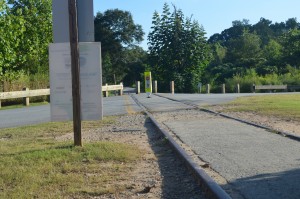
Walking down the incomplete, gravelly trail that is the northern Eastside Beltline Trail is nothing short of relaxing. On a summer evening, predictably, the air is incredibly hot and humid. Insects are everywhere, most likely biting your skin. The smells are reminiscent of any typical nature area or woods. Occasionally, a biker or a runner speeds past you, in their own little world. It’s so easy to feel lost in a little pocket of nature and forget you’re in the urban metropolis that is Atlanta.

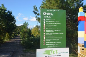
Decorated with seemingly random pieces of artwork, some interactive, always catch attention. They are usually colorful and abstract: not like a painting on a wall. Whether you stop to observe, or simply admire the art as you walk by, they bring much color to the trail.

For an adventurer, many different paths intertwine and connect on this section of the 22-mile long walking trail. Some go off in their own direction, while others may take you on a winding circle. The hidden trails are overgrown, but not invisible. You see them and immediately want to explore, even if it means receiving a hundred insect bites. There doesn’t seem to be one direction to follow on the Beltline.

Aspects of the city tend to creep into this little world, whether it’s a delta plane or the smell of sewage. As you walk, you may venture close to the interstate, and hear the roar of the traffic rush. Some parts of the trail connect to the backs of businesses. After all, the Beltline was not made to be an escape, but a cushion between nature and the city.

More complete sections of the Beltline are more heavily populated on an average evening than the one I travelled. I will refrain from quoting Robert Frost here, but I greatly enjoyed the nearly solitary adventure. The Beltline will inevitably become a great resource for residents all over Atlanta.
 

Annotated Bibliography 1 (Source 3)

http://scholarworks.gsu.edu/cgi/viewcontent.cgi?article=1025&context=sociology_diss

Konrad, Miriam Fiedler, “Transporting Atlanta: The Mode of Mobility under Construction.” Dissertation, Georgia State University, 2006.
http://scholarworks.gsu.edu/sociology_diss/26

In “Transporting Atlanta: The Mode of Mobility Under Construction”, specifically chapter 5, “The Beltline: Great Green Hope”, Miriam Fiedler Konrad thoroughly describes the pros, cons, and intentions behind the Beltline project of Atlanta. The main reason I selected this work over others is because Konrad goes extremely in-depth with the Beltline, referencing multiple scholars and professors throughout the work, giving their thoughts and opinions on the matter as well as her own. The source itself serves as Konrad’s dissertation for her PhD in Philosophy at Georgia State. This is both good and bad for the source as a whole. Given that she’s a student, her opinions on the subject at hand could be considered ill-informed due to her lack of experience. However the fact that she is earning her doctorate degree, and is having to cite many different credible sources to back up her thesis, gives the source much more backbone.

First, Konrad answers the question “What is the BeltLine?” by outlining the first ideas of the BeltLine, showing images, and informing the reader of the groups and individuals involved with creating the concept of the BeltLine. She describes in detail the original purposes behind the creation of the Beltline, as well as different reasons people may support or protest its creation. Konrad then goes into detail about the politics and the funding behind the project, explaining where the money comes from and why. She explains that much of the purpose behind the Beltline is to give Atlanta the aspect of “flavor” that its always lacked. Overall, this Georgia State Alumnus provides a very clear, detailed history and logic behind the Beltline.

Annotated Bibliography 1 (Source 2)

http://scholarworks.gsu.edu/cgi/viewcontent.cgi?article=1001&context=univ_lib_blog

Hurley, Joseph, “1949 Atlanta Aerial Mosaic Project Reveals Built Environment Change” (2014). Selections from the University Library Blog. Paper 11.

This article is written by Georgia State’s very own Joseph Hurley, who teaches on Geographic Information Systems, social sciences, and geography. He teaches the American Studies Cluster seminar, which revolves around mapping historic and current Atlanta.

His article “1949 Atlanta Aerial Mosaic Project Reveals Built Environment Change” shows several pairs of images collected by the Georgia State University Library that reflect the the regional changes that have occurred over the past 50 years. The images depict a mostly residential Atlanta becoming an automobile-driven urban city. They show how buildings, streets, and infrastructure have drastically changed to accommodate the Atlanta commuter. One set of images shows the drastic changes that occurred in the Ponce City Market area, which was once home to a train track and the Sears Robuck Building.

I chose this source for its use of imagery. The pictures shown depict the infrastructural changes that have influenced the construction of the Beltline and other urban renewal projects in Atlanta throughout the years.

The credibility of this source mostly comes from the fact that the images were found with Google images, and that the writer is a well-respected faculty member of the university. His past with geographical history and GIS knowledge helps further his credibility, along with the fact that the article itself was published by the GSU Library.

Eastside Beltline Trail: BED 1 (Artifact 5)

dsc_0040 dsc_0039 dsc_0038dsc_0041

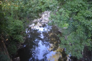
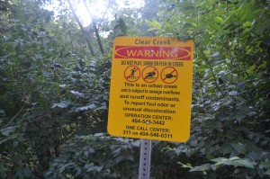
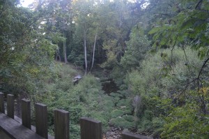
With the smell of sewage, and the sound of running water, I eventually came across “Clear Creek”. While the sight of the inaccessible body of water was nice, the smell was not. The creek provided, for me, a sense of home. Where I live, there are creeks, streams, ponds, and lakes in nearly every corner. The trees, the creek, and the humidity reminded me of home.

The sign that describes how this “Clear” creek is an urban creek that contains sewage, and cannot be swam in, came as a sudden reminder as to where I was located. I was in a city. And this creek, while a beautiful sight, was filled with sewage and “runoff contaminants” that would prevent me from enjoying the water. I suppose there’s only so much you can do to create a sense of nature in the midst of an urban metropolis.

Eastside Beltline Trail: BED 1 (Artifact 4)

dsc_0021dsc_0036dsc_0037

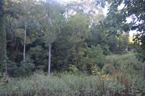
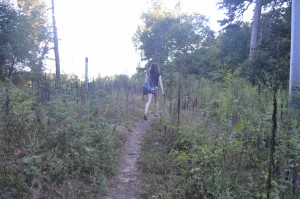
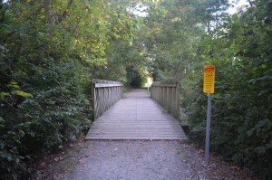
The Eastside Beltline was mostly deserted with the exception of a jogger or biker every 10 minutes or so. As I walked, I could not help but feel isolated in a hideaway inside the city “too busy to hate”. The skies were clear, the wind was calm, and the Beltline was a beautiful site to see. The smells were no different to any park, other than the occasional overpowering scent of sewage. The main trail had several winding, hidden trails, as pictured in the third image. Through following these seemingly secret trails, they usually never led anywhere interesting. The only souvenir I took from taking these hidden paths were several insect bites (whose presence was overwhelming). Overall, the feeling the trail gave was almost an eery, isolated feeling. However, this may be different on weekends.

Eastside Beltline Trail: BED 1 (Artifact 3)

As you walk the Beltline trail, it’s easy to forget you are in the middle of an urban city such as Atlanta. The sound of the cicadas and the rushing water in the creeks make it easy to feel surrounded by nature. However, occasionally the trail comes too close to interstate 85, or a plane leaves Hartsville-Jackson, and the average passerby is reminded of the city. Another factor that comes into play is the occasional stretches of the Beltline that run next to industrial and other business buildings.

Despite the small hints of the city during my walk, I could not help but feel as though I has successfully escaped from the city landscape. The greenery, the smells, and the sounds made me think of home.

Eastside Beltline Trail: BED 1 (Artifact 2)

dsc_0017 dsc_0014 dsc_0013dsc_0011

“The Hidden Trail”

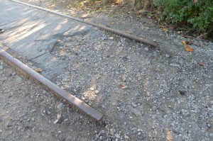
The Eastside Beltline trail can be most easily accessed through the Atlanta Botanical Garden and Piedmont Park. This section of the trail turned out to be very thin, rocky, and generally unnoticeable. Walking around Piedmont Park, the Beltline was virtually invisible. Without looking specifically for the trail, it would have been very difficult for the average park visitor to simply stumble upon the trail. As pictured, the trail has some remnants of its history as one of the main train rails around Atlanta.

On the average weekday evening, the trail seems virtually unused. The occasional jogger or biker may pass by, but there’s nearly no one there. In either direction, there are no big attractions or destinations, just more trail, with the occasional piece of artwork.

Eastside Beltline Trail: BED 1 (Artifact 1)

dsc_0029 dsc_0026 dsc_0024

“Thad’s Shadow”

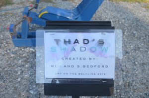
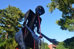
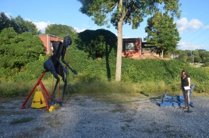
Throughout the Eastside Beltline Trail, numerous mysterious works of art and sculpture can be found. “Thad’s Shadow” was an interactive, mechanical sculpture that required someone to sit down on a blue bench and rotate the pedals to allow the sculpture to move. This movement caused the figure to ring the chimes pictured. The figure itself was very strangely shaped and seemingly random. Any specific meaning behind the sculpture is unknown. It was located in an open, gravelly part of the trail with no other nearby landmarks.


Annotated Bibliography 1 (Source 1)

Link:

https://works.bepress.com/jennifer_j_clark/29/

Citation:

Clark, Jennifer. “Rethinking Atlanta’s Regional Resilience in an Age of Uncertainty: Still the Economic Engine of the New South?,” 2014. https://works.bepress.com/jennifer_j_clark/29/.

Annotation:

Jennifer Clark outlines the economic, industrial, and social transformations of the Atlanta region from over the past 20 years. She provides many credible statistics on graduation rates, GDP rates, and employment rates that apply to the metro-Atlanta area as a whole. She uses these statistics to support the idea that Atlanta is a complicated, dynamic industrial region. Clark spends much of the chapter explaining how diverse Atlanta’s economy is compared to most large urban cities, and how this diversification has caused what she refers to as “uneven transformations” to be added to the city’s infrastructure. She explains how Atlanta’s recent “policies and projects send mix signals” about whether or not the city will prioritize “both the community and the economy”.

Clark specifically refers to both the Atlanta Beltline and Ponce City Market in the section entitled “Uneven Transformations: Twenty-First Century Urban Entrepreneurialism (Universities, BeltLines, Stadiums, and Real Estate Development)”, and she actually refers to Georgia State as well. She mentions how the Beltline and the urban renewal project that became Ponce City Market are both prime examples of urban innovation and economic development strategy. Clark also outlines some of the inspirations behind the BeltLine and specific projects that helped fuel its creation.

Jennifer Clark cites many credible sources throughout her work such as the New York Times, Bureau of Labor Statistics, and many different journals that cover specific issues of Atlanta. The work itself is only a chapter from the book entitled Planning Atlanta: Ruins and Resurgence. Her chapter essentially describes Atlanta’s recent economic tendencies and how the city’s government has reacted to it. With low income rates, employment rates, and graduation rates, the city still possibly made decisions that did not prioritize the improvement of these numbers, which is exactly what Clark describes in her work.

Zotero Link:

https://www.zotero.org/alishiraef/items/collectionKey/5UN3N96R/itemKey/3PGK8EB3


© 2024 Ali Shiraef

Theme by Anders NorenUp ↑

Skip to toolbar