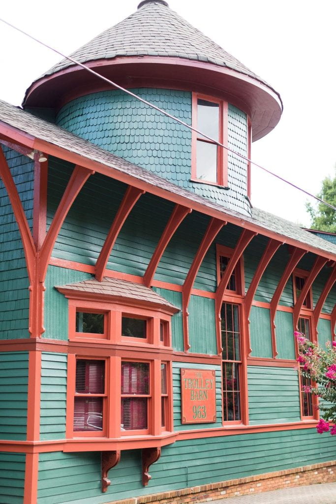
Photograph of the Trolley Barn from Edgewood Avenue1
If you travel down Edgewood Avenue, you’ll pass through historic parts of Atlanta that have a deep and rich history with the city of Atlanta, including through the retail district and into the historic Inman Park neighborhood. This rich history extends throughout Edgewood Avenue, however there is one building which tends to stand out near the east end of Edgewood Avenue, near the Inman Park/Reynoldstown MARTA station — the Trolley Barn.
As has been alluded to in other posts, this area thrived as a predominately Jewish community throughout the early 1900s, with waves of immigration from Eastern European Jews. Several Jewish Synagogues and Congregations could be found in this area. Some of the most notable Jewish congregations in this area included the Beth Israel Synagogue and the Hebrew Benevolent Congregation. However, over time, this Jewish community largely began to dissipate and move to other parts of Atlanta. Many of the Congregations and Synagogues either moved or closed down, and were replaced largely by Christian churches.
As you’re walking around Downtown Atlanta, it’s easy for many of us to miss many of the buildings towering over you as you walk to your next destinations. However, one building that has always stood out to me personally has been the Candler Building for many reasons.
The Candler Building was built in 1906 by the Coca Cola founder Asa Griggs Candler, and features many unique design choices that make it stand out in the landscape. It was the tallest building in the City of Atlanta at the time, with 17 stories, making it tower over the city landscape and surrounding buildings such as the Flatiron Building, built only a few years prior in 1897. This makes the Candler Building one of the first among many of the skyscrapers and towers we see and pass by every day in Downtown Atlanta.
Today, it’s situated next to the Georgia State University College of Law, and only a block away from Woodruff Park and Aderhold Learning Center and the Peachtree Corners MARTA station, among other things. It is impossible to miss when walking around the Woodruff Park and Five Points area because of its unique V shape and its nature of towering over the area. I’m sure almost every Georgia State student, myself very much included, has looked at and observed this building at some point in walking around the area.
It also has a unique design and art style surrounding it that I’ve always found interesting to look at and observe, which helps make it stand out from a lot of other buildings in and around the area, a lot of which are boring or don’t have much in the way of detailed character to them, in my opinion. It’s also an important relic that still stands in the city skyline from over a century ago, which helps draw the eye to it even more in a city landscape dominated by a mix of buildings built and designed throughout the last 100 years.
The Building had many uses over the years, including serving as a high class hotel, hosting restaurants and serving as the headquarters for the Central Bank & Trust, also owned by Candler. This bank eventually merged into what would become the precursor to the Bank of America, showing the kind of history that this building holds in the city.
Either way, I think that this building serves as a very important historical marker in the city of Atlanta and it’s evolving landscape, and I think that the design and style of the building has always been some kind of a point of attraction or point of interest for me as I walk around the downtown area.