3D Reconstruction of 81 Decatur Street Project
Hey Guys!
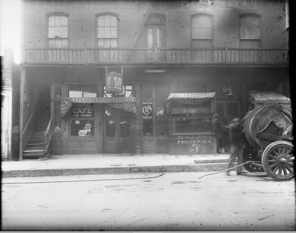
Just wanted to talk a little this week about the project some of the SIFs and I are working on! It’s been a rough week due to a stagnant cold that’s been ailing me, but we’ve managed to accumulate a lot of good data to throw at this project. What is it you ask? Well–every time you happen to walk by Classroom South on Decatur St, there is actually a rich history swept underneath the building that now stands there, namely 81 Theatre. It started as a Vaudeville stage and slowly evolved into a popular African American theatre in the 30s onward. The street was bustling with activity–pool halls, barber shops, clubs…it was an extension of the Auburn Avenue community’s spark.
So our team wants to rebuild this block of Decatur St as an interactive environment–a game of sorts. If you’ve been reading my blog up until this point, you’ll know how into gamifying experiences I am. By adding a layer of engaging interactivity to this historical environment–we hope to promote education through engaging experiences that reflect what the different departments we represent do best: English and Literature, Anthropology, Geography, and Computer Science. It’s one thing to build a historically accurate 3D environment through maps and computing–it’s another thing entirely to fill it with narrative and meaningful culture that grabs attention and keeps it engaged. Can someone interact with this small microcosm and leave that interaction knowing more about the past than they realize? It’s hard to say, but I’m confident we’ll do a good job between CURVE and the Exchange’s combined resources.
Here’s a screen grab of the very primitive block I’ve started building. The placement textured facades of buildings have exact widths that are historically accurate. I’m working on the heights. How am I getting this information? Glad you asked. GSU’s library has a vast, untapped resource of historical maps and photographs from the 20s, 30s, and 40s. The maps are various city planning maps that contain incredible details: sidewalk widths, facade widths, interior measurements, occupant business names, placement of fire hydrants, sidewalk materials(tiled or granite), street car lines, and much more. Combining these maps with the numerous photographs we’ve already found–we have incredible historical detail to work with.
We’ll be sure to keep you updated on the progress we accomplish! It’s going to be awesome.
Cheers,
Robert


To me this is one of the very best projects in the SIF program. I would love to what you guys are working on sometime. Have you talked with any of the people in the history department, Cliff Kuhn and Richard Laub in particular, who are Atlanta history experts and public historians who would probably very interested in this project?
Dylan