Tracing a History of Atlanta’s Public Transit
Project details
Student: Student Innovation Fellows
Instructor: Joe Hurley
Institutional Assistance: CURVE, the Planning Atlanta Collection
Technology: ESRI Story Map
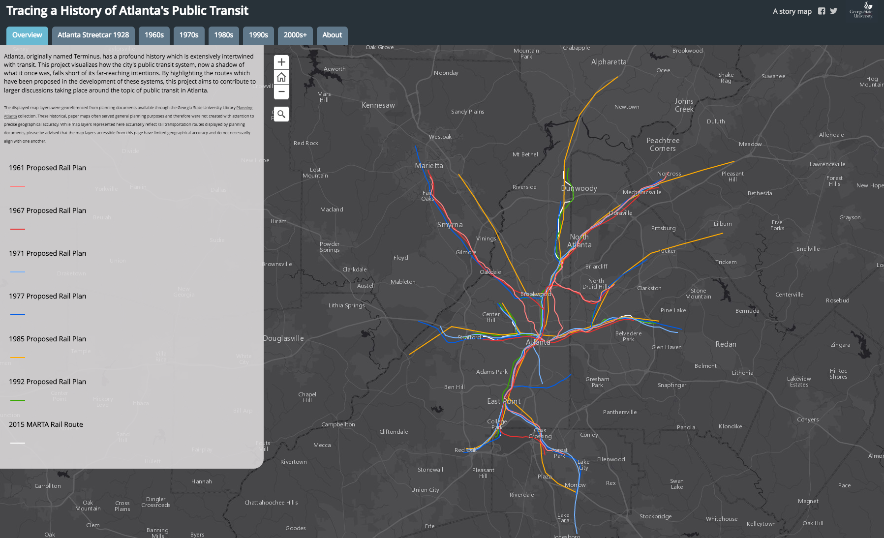
Atlanta traffic is regularly in the news, and public transit is often mentioned as a possible solution. Many Atlantans would be surprised to find that we had an extensive streetcar system in the early 20th Century, and that early MARTA proposals in the 1960s went much further than the current rail lines today. As we think about solving our transportation problems, it’s important to look to our history of dealing with this complex issue. With this in mind, Student Innovation Fellows led by GIS Librarian Joe Hurley digitized transportation maps in GSU’s Planning Atlanta Collection to allow viewers to see our city’s previous rail systems and plans that were never fully put into place. The students learned about several mapping technologies and about Atlanta’s history of struggling with the issue of transit. The project was written up in the Atlanta Studies blog and by local blogger, ATL Urbanist.