Some final thoughts – for now.

I started down this path with an interest in 3D modeling of caves. I was experimenting using a kinect to build a 3d model but it was clunky and unwieldy. I ran across the term “structure from motion”… which just means that you can recreate 3D structure from the motion of a camera through a scene – the practical result of which is that you can create a 3D model from photographs. I am convinced thoroughly that this method should become widespread in all sorts of digital collections. I presented this year at the Society for American Archaeology (SAA) Annual Meeting on creating models which are measurable comparable to the real world measurements. This process is simple to implement and the photographic techniques required relatively simple – but the benefit is rich 3D content which can be shared or recreated in a multitude of ways.

This is not limited, of course, to archaeology. This can be used to share art, architecture or landscape content – anything really. The NPR show Radiolab had a segment about a paleoarchaeological find of a human ancestor which was accompanied by a 3D model which was intended in the absolute best case scenario to be 3D printed and held while listening to the episode. This is an incredible feat – one of the first in which an extraordinarily rare find was made so accessible through the use of 3D scanning. 3D structure from motion means that no longer do you need a laser scanner – the model I created for the SAA meeting and that I will attach here was created with nothing but a camera and some computer time. Agisoft Photoscan is incredibly good at this point. As part of my work as a student innovation fellow I have been developing lesson plans – one centered around accurate terrain modeling from UAS photos and the other based on modeling objects with handheld photographs – which I will post here once I finish editing some of my stream of consciousness out of them – and make some better figures.

Some of the most recent beneficial developments in Photoscan have been improvements in the auto-detecting markers that Photoscan can produce. Experiments with this system so far have shown it to be pretty reliable in detecting the markers correctly which greatly simplifies the creation of accurate, measurable models.

I find it fitting that as I wind down the semester and look towards my next steps I find I have been invited to, finally, tackle the problem which initially led me down this path of discovery with regards to 3D modeling – caves. During and then after my undergraduate degree I worked at a site with a number of caves known as Pacbitun. I will be returning there this summer to assist with creating 3D models of the very same caves that got me interested in this realm.

This is all to say nothing of the other major avenue I have been pursuing as a Student Innovation Fellow – Unmanned Aerial Systems.

So, it has been well over one year now since I was first exposed to the use of unmanned systems in archaeology. Where are we right now, and where are we going?

This year saw the first dedicated session at the Society for American Archaeology Annual Meeting, chaired by Dr. Gerardo Gutierrez of the University of Colorado, Boulder.

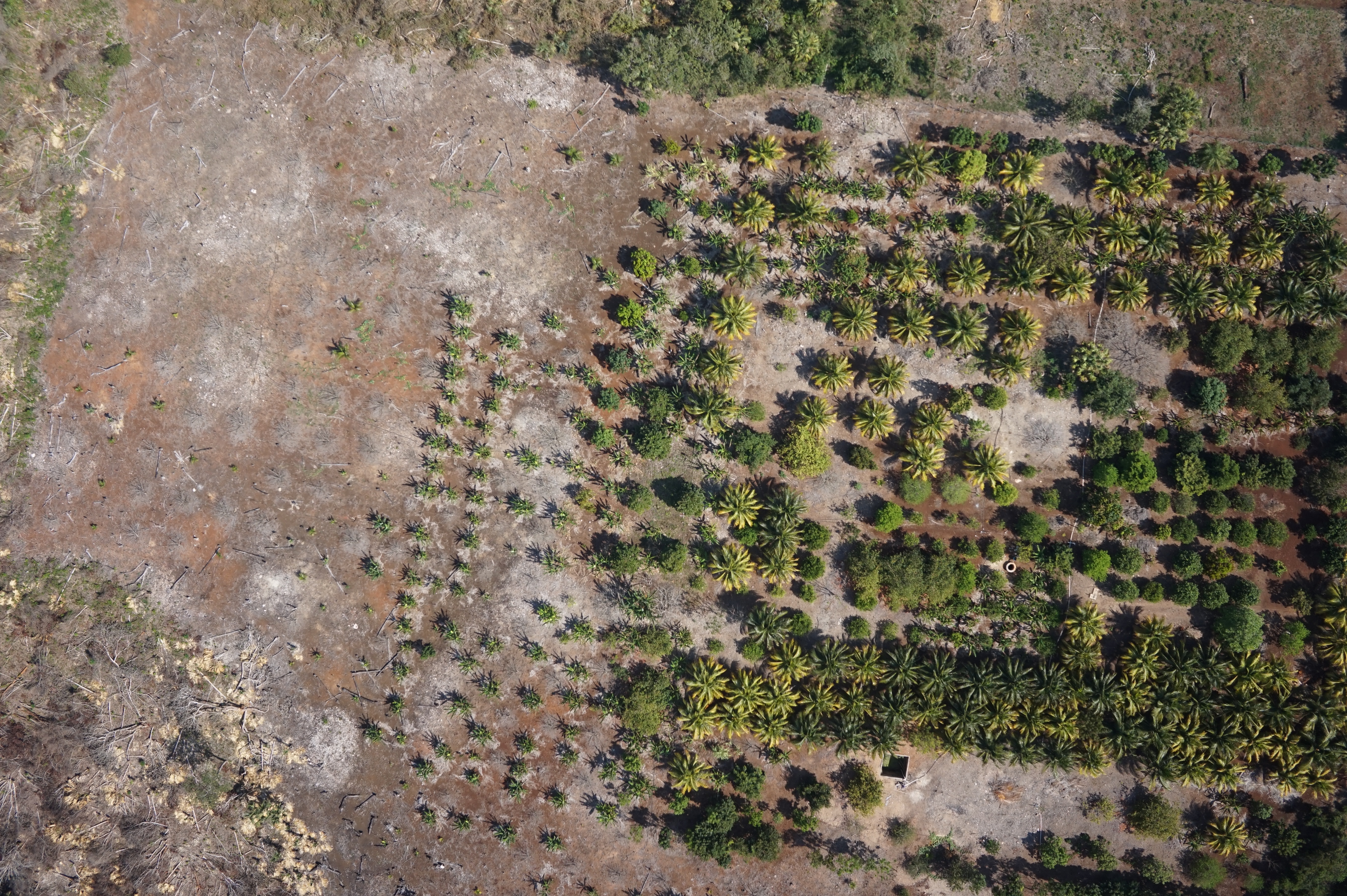
The papers in that session made one thing clear, one after another – Unmanned Aerial Systems – yes drones – are going to be a part of the future in archaeology. They will revolutionize the field in many ways, allowing access to unprecedented levels of detail and control in aerial data collection. However the biggest lesson I took away from my work is that – despite the success had drones are not the answer much of the time. It is often easier, safer and more cost and time effective to collect imagery using handheld cameras and perhaps some creative photography gear (like gibs or “selfie pole” style sticks) rather than using a drone.

When you do cross over into needing an unmanned aerial system there are a number of routes to take – DJI offers an easy to use product that nevertheless suffers from some persistent flaws. Better autopilots exist but at the expense of needing an expert to set up and maintain the aircraft. There are also very very expensive “automatic” systems which are heavily computer controlled and as a result can be operated by nearly anyone… and did I mention VERY expensive?

So, when should you use a drone? Fixed wing aircraft excel in many respects but are limited by takeoff and landing requirements. Multi-rotors suffer from a number of limitations, chiefly battery life, but excel in maneuverability. Anywhere that takeoff and landing space is limited is a good candidate for using a multi-rotor system. Both of these systems are limited by the skill of the pilot in the terrain provided. In a dense enclosed environment where most of the area of interest is beneath the canopy, using unmanned systems in general may be unnecessary or even dangerous.

Moving forward, unmanned systems will continue to see increasing use in archaeology and related fields. This will coincide with increasing use of these systems in other fields, including geosciences and agriculture. As the FAA begins certifying pilots and systems for commercial and research use in the US drone based project will be come more and more common.


Intercoastal Collaboration and Innovation Abroad

As an archaeologist, it is understood that one must wear multiple hats – as it were. During my time at Georgia State University I have worn many – Anthropology Student, Archaeology Student, Mentor, Student Innovation Fellow and Graduate Assistant – to name a few. I am also a member of Proyecto Costa Escondida – an archaeological project which spans multiple institutions and fields. Through this project I have the opportunity to collaborate with other students from around the nation – and in fact the world.

This semester I have been working on coordinating a field season with other members of the project from the University of California San Diego – Students of the Center of Interdisciplinary Science for Art Architecture and Archaeology (CISA3). This field expedition has a number of purposes within the scope of the Student Innovation Fellowship. Primarily – the students as CISA3 who joined me in Mexico this March are interested in the same sorts of uses for Unmanned Aerial Systems in scientific research that I have been working on this past 2 semesters. However, these students represent a cross section of the technical experts and innovators – though with different specific skill sets – similar to those students sought by the Student Innovation Fellowship The notable difference being that CISA3 is an established institution. CISA3 was able to provide incredible support for this field expedition, funding travel and accommodations and providing additional aircraft – in addition to the students.

The goal of this collaboration was to jointly develop best practices for the deployment and use of Unmanned Aerial Systems in scientific research. Because of the experience afforded so far by the Student Innovation Fellowship – I was uniquely positioned to contribute to this venture. By encouraging development of skills and ability well outside of the usual purview of an archaeologist I “hit the ground running” so to speak. This field season and the results from it represent one of the major accomplishments of my time as a student innovation fellow.

In the 4 days of flying data we have looked through so far – over 1,000 km of missions with 40,000 photos – the mission was an incredible success. We captured near infrared (NIR) and visible (RGB) imagery over many areas of interest. The primary task now will be the processing and analysis of the imagery collected. Below is a sample of images collected during this field season. For my next post I will have results from preliminary checks of the 3D modeling phase of data processing.


NIR, Image of cattle pen on a Rancho.

NIR, Image of cattle pen on a Rancho.

NIR Image of the main Platform at Conil.

NIR Image of the main Platform at Conil.

NIR Image of fields.

NIR Image of fields.

NIR Image of a historic canal.

NIR Image of a historic canal.

RGB image of fields and forest.

RGB image of fields and forest.

RGB Image of cleared field.

RGB Image of cleared field.

RGB image of Punto Gallo.

RGB image of Punto Gallo.

RGB image of fields and forest.

RGB image of fields and forest.

RGB image of road and forest

RGB image of road and forest

RGB image of wetland oxbow.

RGB image of wetland oxbow.

Wetlands and mangrove.

Wetlands and mangrove.

Fresh water flowing into brackish wetlands near Vista Alegre

Fresh water flowing into brackish wetlands near Vista Alegre

Wetlands and beach near Vista Alegre.

Wetlands and beach near Vista Alegre.

RGB Image of Conil

RGB Image of Conil

RGB image of an orchard.

RGB image of an orchard.

Flying in manual mode.

Flying in manual mode.

DSC_6942

Thoughts on the Recent Proposed FAA Action on Unmanned Aerial Systems

Federal regulations have never been a bigger part of my life.

As many of you may have heard, this week the Federal Communication Commission enacted regulations which classify internet carriers as utilities, and requiring them to behave in a certain manner.

They announced these rules and in a blink of an eye enacted them.

By contrast the Federal Aviation Administration has been dragging their feet in enacting regulations which would pave the way for the full scale commercial use of unmanned systems in the US. Recently the FAA also published the first part of their proposed regulations which would do just that. They won’t be pulling an FCC any time soon though, and enacting these regulations almost overnight. Today I’m going to give you my thoughts on what they have proposed, as well as all the information I can find on what the other parts of the regulation may look like when they are finally announced.

FAA Rules:

For UAS under 55 lbs AUW:

  • Operator Certification: All aircraft operators must have a current, valid FAA Unmanned Systems Operator Certificate. This does not require a full or regular pilot’s license of any sort.
  • Permission: Overflights by a commercial entity cannot be conducted without the permission of the land owner.
  • Altitude: Aircraft must remain under 500ft above ground level and out of “transponder airspace” (areas that legally require you to announce yourself to ground control, usually above populated areas, but ground to 500ft is also allowed  almost everywhere except near airports.).
  • Eyes on: Aircraft operator must keep the aircraft within visual range at all times.
  • There is no requirement for “100% full manual control”. That is, it seems that autonomous flight is allowed, but not beyond visual range.

These operational guidelines are pretty relaxed compared to some proposed variations that have circulated over the last few years. This is the first of what people believe will be 3 general classes of commercial licenses for unmanned systems. Another class will be for aircraft with less than 4.4 lb all up weight (DJI Phantom class). These will likely not require any special operator certification. Otherwise it will follow the above rules for altitude, permission and visual flight rules. The under 55 lb is the middle of the three classes. The higher end class or classes are currently not fleshed out on the FAA end. They will likely allow higher weights Or autonomous flight modes beyond visual range, and will also allow for the use of “optionally manned” type features for full size aircraft already being sold. It’s highly likely they will require some very costly and as of yet unreleased collision avoidance technology to be integrated.

At a minimum this likely means UAS specific models of ADS-B collision avoidance GPS units that are already being implemented in the US and Europe. This device allows an aircraft to detect its own position from GPS and then broadcast it to nearby aircraft. This would be incorporated with a receiver which is able to tell the autopilot about a potential collision and together with the transmitter, the human pilot and the autopilot can self-separate without the need for ground control intervention. The aircraft will also likely have FAA airworthness or experimental certification requirements at some levels within these classes, mostly dependent on the all up weight. Implementing the requirement that aircraft use this system is currently the biggest headache for the FAA, and it’s much more serious than the UAS regulations as it impacts business which are already up and running. Adding another layer of complexity to the implementation of this system is unwise, which is why we will likely not see any of these “higher end” classes opening up until the ADS-B issue is sorted in the national airspace.

Major Take Away Points:

  1. All Academic UAS that falls under this scope will be fully above board in the eyes of the FAA when flying in the United States. Previously, University UAS operations in the US (including our own) were flying under hobbyist exemptions when operating in the US, and had some very quirky limitations.
  2. There are clear guidelines to be followed at a federal level. In the (current) absence of state legislation, the FAA rules should prevail. Previously, we have shied away from operations that should be legal but are likely to draw high levels of public attention or “cause a stir”. As long as we follow guidelines, these projects could be undertaken now.
  3. There will need to be a program for training/certifying UAS pilots at the University level, if we desire to continue pursuing UAS as an institution. The currently announced FAA guidelines require an operator certification. It’s unclear how burdensome this will be to obtain, but one of the supposed models for this aspect legislation is the Model Aeronautical Association of Australia (MAAA), where UAS certifications are not particularly burdensome to obtain (like an amateur radio license, which is another requirement for this work). However, this will likely require some level of formal training, even if it’s a few nights of studying a test guide.

What can you do with Unmanned Aerial Systems?

Unmanned Aerial Systems (UAS) is a very broad topic.

Part of my role as a student innovation fellow is to build and experiment with UAS, with the goal of developing a “Manual” for UAS use at Georgia State.

The manual will include both safety and technical information, as well as some basic flight instruction and guidelines for use.

To that end, my post today will consist of a pretty “stream of consciousness” discussion of what is available and what is possible with unmanned aerial systems in a University setting. I will also go over the differences in the various types of UAS and their pros and cons. The reason I ask this is, is that I have a somewhat narrow focus when it comes to the use of these aircraft. I want to know what sort of ideas you can come up for using Unmanned Aerial Systems in a University setting.

Aerial Photography or Videography is the primary use of most UAS in academic or research settings. There are many different variations on this role. Cinematographers and photographers have been using UAS to achieve an airborne perspective with low cost in many fields including journalism, entertainment and real estate. Other Colleges and Universities are using them on sports fields to analyze athletic performance from a new perspective. Governments and utilities have used cameras in the air to perform critical infrastructure inspections, and still others have used small unmanned aircraft to survey large swaths of land with high resolution aerial imagery.

It’s by changing the actual imaging sensor used to take images that the capabilities of unmanned aerial systems start to diversify. Simple photography uses a Red-Green-Blue color representation in “Natural Color” imagery, but the electromagnetic spectrum is very wide and visible or natural colors only make up a small portion of that. NIR or Near-Infrared imagery is one of the simplest to acquire. NIR light is that band immediately adjacent to red but beyond the human visual spectrum. NIR reflectivity can be used to help assess plant type or health, and is widely used in environmental and agricultural research. Typical off the shelf consumer cameras are often capable of recording the NIR band with the removal of a simple filter, however the inconsistencies from one model to the next and one filter to the next make these less than ideal for scientific research. A small cottage industry in NIR modified cameras has developed, targeting scientific researchers with inexpensive but consistently and correctly modified cameras.

Moving further away from visible/natural light you come to Thermal IR. Even though its still Infrared, Thermal IR cannot be easily captured by a consumer camera. Thermal IR is also known as Thermal Radiation or just “Heat”. Thermal IR sensors are much more expensive than NIR. These cameras allow the operator of a UAS to view temperature differences. This is useful in a number of fields, such as wildlife management or infrastructure inspection. Other than the cost of the sensors, these capabilities are essentially just specialized applications of aerial photography.

Mapping can also take on another dimension, when the aerial imagery is used not only to build an orthophoto mosaic of the land being mapped, but also to reconstruct a 3D model of the terrain. This is the primary use of Unmanned Aerial Systems for me, however I realize that many of you will have many more ideas for how to use these systems to further interesting projects that you come up with.

As for the types of systems, there are two primary types of aircraft in use for UAS, and their capabilities, advantages and disadvantages are similar to their full size manned counterparts. Fixed wing UAS look like a traditional plane or “drone” with a propeller for thrust and wings for lift. Like a traditional helicopter, a multirotor spins a propeller in order to generate thrust. A multirotor then changes the vector of that thrust to generate motion, both horizontally and vertically.

A fixed wing UAS is the go to solution for any application where any of the following are of overriding concern: Flight time, Power efficiency, Range, and straight line speed. For large aerial surveys or other long range, long duration missions a fixed wing provides a significantly more robust platform. Because the wing generates lift through forward motion, fixed wing UAS are generally unable to hover, but because that forward motion is what keeps the vehicle in the air, they are much more efficient than multirotors when it comes to power use/flight time.

A multirotor is going to be most useful where extremely accurate and precise maneuverability are needed over all else. Because a multirotor uses thrust to move both horizontally and vertically, it’s possible to ascend vertically as well as hover and strafe from side to side. This allows for extremely accurate and precise camera control in 3D space.

So, there you have it.

I’d love to hear what ideas you all have for using these systems.

Space, Settlement and Environment: Using Remote Sensing to Identify Hidden Maya Sites

So far this semester, I have made progress on many fronts, not the least of which involves my thesis research. Anyone reading my blog regularly will have gotten a taste for my own internal dialog in navigating the theoretical hurdles inherent in conducting independent research. In the past few weeks this internal dialogue has transitioned into the begging stages of writing my thesis. In the spirit of innovation I have decided to try an experiment. Today I will be writing my abstract and introduction in the form of a blog post. There are multiple points to this exercise. As the primary audience for this blog is my fellow innovation fellows, I am hoping to get some feedback on the status, intent and general theoretical stance of my thesis. I won’t be subjecting you all to the rest of my thesis in this manner, but writing the introduction first is new to me and I feel that the introduction, if well written, should be well received by you, my audience. So, here we go:


Abstract:

This study utilizes an integrated remote sensing approach to augment settlement pattern survey in archaeological research in the Yalahau region in Northern Quintana Roo, Mexico. It has long been acknowledged that archaeology has harbored an inherent bias towards the “center” of things. In recent years, some archaeologists have shifted to a more landscape and settlement pattern oriented approach for archaeological research. Coupled with this has been an increased interest in human-environment interaction within archaeology. The Yalahau region of Northern Quintana Roo has a long history of human occupation as well as a sensitive combination of environments. Coasts, wetlands, high forests, low forests, agricultural fields and towns all sit above a porous karst geology. Interactions between humans and the environment can, and do in the right circumstances, produce impacts which may remain detectable many hundreds or thousands of years later. By utilizing various sensors (LiDAR, GeoEye, Landsat VII and VIII, other imagery) and collection methods (satellite, aerial) as well as processing (band combinations, tasseled cap) and cross referencing the data it is possible to generate a signature which strongly correlates with the presence of evidence of prehistoric occupation. Field verification of these identified signatures was conducted to assess the “Ground Truth” of the presence or absence of archaeological material. The results of this investigation are presented together with other regional settlement pattern data in order to assess the status of a number of methodological and archaeological questions as well as to supplement regional data already available.


The primary question I have for my abstract is what specifically should I cut to retain the most information about what is actually in my paper, in the event that it needs to be cut for to satisfy word count restrictions?


Introduction:

Investigations into prehistory in Quintana Roo date back to the very first decades of the colonization of Mexico. John Lloyd Stephens brought the Yucatan back to US populations, publishing hundreds of carvings and illustrations, as well as a compelling travelogue narrative of his years of journeying throughout present day Yucatan and Quintana Roo. Human occupation in the region dates to the archaic or earlier and many very early Pre-Classic period Maya sites exist throughout the region. Maya groups still occupied some sites through contact with the Spanish in the 1500’s and many Maya reside there today. The modern environment of Yucatan and Quintana Roo consists of both High and Low tropical forests and wetlands sitting atop a porous, karstic ridge. The tropical environment makes site discovery challenging, with visibility often limited to a few tens of meters walking on the forest floor.

As archaeological investigations have shifted away from the center/site paradigm, and towards “Landscape Archaeology”, emphasis has expanded on studies of “Hinterlands” and other euphemistic terms for sites which are investigated not for their grandiosity but for the stunningly every-day nature of the findings. These types of investigations are multi-scalar and emphasize center-periphery interactions as well as human-environment interactions. For these types of investigations understanding the distribution of human occupation on a landscape becomes a key component of interpreting the archaeological record.

This increased emphasis in human environmental interaction in the past has coincided with the current surge in modern environmental research. In fact, archaeologists around the world have been contributing unique knowledge about past human environment interactions to the current global political debate on climate change. Within archaeology, this has coupled with an increase in research into detecting human environmental interaction in the past. This has also lead to a funding boom, for example the National Science Foundation has made available grants for researchers investigating “Coupled Human Natural Systems” both in the present and past and NOAA has funded human-environment interaction research in Yalahau in previous field seasons. It is becoming clear that among archaeology and environmental science that human beings can and do have lasting impacts on the environments in which we live, which can remain detectable for many hundreds of years.

This thesis addresses whether it is possible to remotely detect archaeological sites under tropical forest canopy in the Yalahau region. By combining a variety of sensors such as Airborne LiDAR, Landsat VII and VIII in addition to with previous survey results it is possible to develop a signature of known archaeological sites in the region which can be used to detect previously undocumented or unrecorded sites. I use these terms explicitly, as in the course of my investigations it became apparent that there is, in fact, nothing new under the sun. Every site which I field verified in the course of this thesis was known, in many cases long known, by the local informants that eventually brought me to the sites. In the end, they were the heroes of yet another field project in this region. Finally, I examine the results of this program of remote sensing and verification in the context of the previous field survey upon which my own research is based. Together, both the previous survey and my own remote sensing based research are much stronger and provide a more complete picture of settlement pattern than either method is able to produce alone.


 For the introduction I have the opposite issue. What would you, the reader like to see expanded? Also, more broadly: What questions would you, the reader be expecting to have answered at the conclusion of the paper this is introducing? As most of you are non archaeologists, I want to understand the questions a non archaeologist would have reading this work, in order to increase the utility of this research for those in other fields wishing to incorporate archaeological data into more contemporarily oriented research programs.

Social Theory and Popular Culture

Earlier this week I was reading and thinking about the problem of trying to practice science with weight of the post-modern critique weighing heavily upon all scientific analysis of human behavior. In archaeology, it’s more or less fair to label the archaeological theories with their corresponding broader social theories thusly: Processual or “New” Archaeology is equivalent to modernism in art and philosophy. Post-Processualists are the post-modern archaeologists. But what do these terms mean?

Modernism is complicated, but in my own, paraphrased and summarized view it can be seen as the idea that the world, or your work, can be made objectively better through quantification and calculation. In broader terms it’s the idea that the advancement of science and technology will solve all the problems of the world and achieve a bright and shining future.

Post-Modernism is the recognition of the limitations of the modern way of thinking, of how the flaws of relying completely on modern technology which is limited and burdened by the baggage of the past. Post-Modernism is the full on embrace of snark culture, and it requires a recognition of limitations and a sense of self deprecation.

There are many other schools of thought, but these are the broad themes at play in most fields of theory.

Lots of students have issues tying theory to the practice of anthropology or archaeology. I suspect the same is true in other fields which have theories to teach. Students ask what sort of impact these types of world views can actually have. I will now give an example of how a cultural zeitgeist can modify the structure of institutions by looking at the dawn of the post-modern era in college football.

The Bowl Championship Series (BCS) was the modern era of football. An algorithm took a representative democracy of football elite and combined the results of their voting with a mass of different calculations based on the detailed statistical record kept of every game. The idea behind this is that through technology and science it’s possible to pit what should be, objectively,  the very best two teams against each other in a final game.

In the last decade of the internet, a certain trend towards sarcasm and cynicism has been essentially leaking from the internet into the rest of society. The way in which the polling was conducted, and the formulas spat out a result which we followed blindly, whether it made sense or not (for instance, putting teams which lost conference championship games on the pedestal to potentially be National Champions because of statistically outlandish performances earlier in the season) became a sore spot for many fans of college football.

The snark and sarcasm surrounding the “BCS Madness” culminated in the NCAA ending the BCS and instituting an extremely abbreviated (2 rounds, 3 Games, 4 teams) playoff post season. The 4 teams which would form this playoff bracket would be selected be a committee of football experts which have the express goal of applying human nuance and interpretation to football. For example, it’s extremely difficult for a computer to deal with injuries in the formulas which were used in the BCS era. A human can look at a team and notice that an injury is going to hurt the teams prospects very badly despite their previous successes. Simply put, the human brain is, with all it’s biases and issues, much better at certain types of very complicated analysis for a very complicated and very human purpose.

What I mean, I will illustrate by a further example: Henry Ford once said that if he had asked what people wanted, they would have said faster horses. Likewise, what college football fans say is that they want the best teams to play for the championship. What they actually want is the best game, and the assumption is that the absolute best teams will make for the best game, like the average person in Henry Ford’s era would have assumed that the best way to get from point A to point B faster would be to ride a faster horse, even though this is not always the case.

By transferring the decision making in college football back to a handful of informed individuals, the NCAA is able to more effectively build a post season that will please the most fans. I held off on posting this until final announcement’s were made. Ohio State will be playing Alabama and Oregon will be playing FSU. The games are just about the best you could have asked for after all was said and done with this season, but in the end it doesn’t matter what I think. The NCAA realized that the modern idea that we can calculate our way to better football ignores something fundamentally human about an athletic competition, and that fans and the NCAA are better served by allowing the human touch, rather than by trying to eliminate any perception of it from the final results.

Collaboration in Action

Earlier this semester , Georgia State Anthropology hosted a visit from Dr. Dominique Rissolo. Dr. Rissolo is an accomplished researcher and is currently a program director at the Waitt Institute and is also involved with the Center for Interdisciplinary Science for Art, Architecture and Archaeology (CISA 3). Dr. Rissolo was catching up with long time friend and GSU Faculty Dr. Jeffrey Glover, as well as presenting talks on Grant Writing as well as a National Geographic Institute research program at a Cenote in Quintana Roo known as Hoyo Negro or the Black Hole. He was also checking in as committee member on my thesis research as well as a GSU colleague of mine. Dr. Rissolo conducted his Dissertation research in the region of Quintana Roo where I am doing research for my thesis.

We decided to catch up on thesis research at CURVE, as the venue proved ideal for looking at the kinds of data archaeologists deal with.

_DSC0884

_DSC0879

_DSC0875

Archaeology and Cartography: Why Theory Matters

Maps are graphic representations that facilitate a spatial understanding of things, concepts, conditions, processes, or events in the human world. [Harley and Woodward 1987:xvi, quoted in Crampton and Krygier 2005:17]

Maps and archaeology have a long history. Heinrich Schliemann produced many maps and plans through the course of his excavations in what he deemed ancient Troy (Schliemann 1884). Spatial interpretation at all scales has long been part of the archaeological discourse (Ashmore, 2002; Ebert 2004). Ashmore (2002:1173) states “Myriad scholars, in the United States and elsewhere, have long sought to reconstruct social (or societal) organization from the archaeological record, as viewed through artifacts and features mapped across space (e.g., Chang 1958; Childe 1951; Fox 1932)”. Trends in archaeological cartography have followed those broader themes in archaeological theory as well as in cartographic, geographic and social theory. The “completion” of a map of Teotihuacan in 1970 (Millon 1970) after 8 years of work beginning in 1962(Millon 1964) is a great example of the state of spatial archaeology prior to the advent of Geographic Information Systems (GIS) Technology. This project can be seen as a processual consumption of what Crampton and Krygier term “Scientific Cartography” (2005:20). That is, the use of techniques, method and theory for creating more accurate maps developed during and after the Second World War for the purposes of archaeological research. Million (1964, 1970) describes the project in detail, the methodology used and the attention to detail and accuracy by the project members in the creation of the map. It is seen as a descriptive tool, context for explanation.

To this day archaeologists remain consumers of cartographic methodology, and thus of cartographic theory. It is important then to trace the history of theory in cartography and geography in the broader context of general social theory. The critical drive in cartography stems from a rejection of Robinson, Jenks and Morrison’s attempt to create a methodologically “pure” cartography, devoid of politics or bias, simply representing the world as it is (Crampton and Krygier 2005). Post-processual archaeology and critical cartography both recognize the situated-ness of knowledge (Crampton and Krygier 2005; Trigger 2007, 467- 468). Both stem from postmodernist philosophy on the creation of knowledge, as Trigger explains: “Postmodernists agreed that there could never be a single objective version of human affairs; instead there were multiple versions or truths seen from different standpoints, such as those of poor and rich, winners and losers, females and males, different professions and various ethnic groups” (2007:447).

In the face of the potential demise of objectivity the Robinsonian pursuit of pure cartography was seen as problematic at worst, and misguided at best. Monmonier states this in an extreme way, “A single map is but one of an infinitely large number of maps that might be produced for the same situation or from the same data” (1996:2). The sustained critique of the objectivity of scientific inquiry, whether it comes from post-processual archaeologists or critical cartographers has undoubtedly had an impact on the uses of GIS and other forms of computation in archaeology. Geographic Information Systems, like other forms of information systems should be viewed as one of many possible tools to investigate archaeological and ultimately anthropological research questions.

Other Archaeologists have approached this issue from other angles… The issue is multifaceted, it is one of translation as well as representation. The fact of the matter is that archaeologists, as specialists in another discipline, are forever consumers of of Cartographic theory, typically of whatever theoretical paradigm is the mainstream. Gillespie (2007) looks at this issue in terms of the interplay between technical method, archaeological questions, and theoretical leanings in the context of the maps of the site of La Venta, in Mexico.

Gillespie looks at over 100 years of drawings of the site of La Venta, both plan views of the architecture present at the site, as well as profiles of excavations. If the general layout didn’t stay the same, and we didn’t know in most cases without a doubt know that these maps are of the same part of the same site… you might believe you were looking at two or more physically distinct sites. Part of this is certainly due to increasingly extensive clearing as well as excavation. However many of the maps seem to show a fictive layout of proposed or archaeologically determined building footprints, as opposed to the actual current physical state of the site. Others show both current physical state was well as archaeological footprints concurrently, or differently for different parts of the site. There is no coherent way in which each element of the site is represented on the various maps through time. This presents a problem for modern archaeologists attempting to make sense of excavations conducted a century ago on a scale that is no longer possible on a site which no longer exists.

This is one of the primary reasons why 3D reconstruction of archaeological sites can be such a powerful too for archaeology moving forward. A 3D model of a unit contains far more data than the corresponding interpretative maps can possibly convey. The models can be re-interpreted as understanding of the cultures, archaeological theory, or the site stratigraphy develops. Interpretative or thematic maps can be re-drawn from the 3D model, years or decades after the excavation unit is closed, reburied and long gone. Of course, it’s tempting to think of the model as being representative of the real world, but unlike every other mapped set of data, it’s actually a translation and an abstraction, itself limited by technical as well as interpretative factors.

I will deal more with the specific challenges and limitations of 3D modeling for Archaeology in my next post.

References

Ashmore, Wendy
2002 “Decisions and Dispositions”: Socializing Spatial Archaeology: Archeology Division Distinguished Lecture 99th AAA Annual Meeting, San Francisco, CA, November 2000. American Anthropologist 104, no. 4 (December 1): 1172–1183.

Crampton, Jeremy W., and John Krygier
2005 An introduction to critical cartography. ACME: an International E-journal for Critical Geographies 4, no. 1: 11–33.

Ebert, David
2004 Applications of Archaeological GIS. Canadian Journal of Archaeology 28, no. 2 (December): 319–341.

Gillespie, Susan D.
2011 Archaeological Drawing as Re-Presentations: the Maps of Complex A, La Venta, Mexico. Latin American Antiquity 22(1): 3–36.

Millon, Rene
1964 The Teotihuacan Mapping Project. American Antiquity 29, no. 3 (January 1): 345–352.

1970 Teotihuacán: Completion of Map of Giant Ancient City in the Valley of Mexico. Science 170, no. 3962 (December 4): 1077–1082.

Monmonier, Mark, and H. J. de Blij
1996 How to Lie with Maps. 2nd ed. University Of Chicago Press,

Schliemann, Johann Ludwig Heinrich
1884 Troja: results of the latest researches on the site of Homer’s Troy.

Trigger, Bruce G.
2006 A History of Archaeological Thought. 2nd ed. Cambridge University Press, September 11.

The Politics of Language

Drone


The above image is a snip of a search on news.google.com for the word “drone”.

It’s important to know the political impact that the words you are using. Language shapes perception, and the overarching themes surrounding the word “Drone” revolve around the use of armed US Drones in military actions around the world. Whether you want to or not… whether you are an aerospace researcher developing systems for the US military, or you are environmental scientist using them to research plant health, you are conjuring up an imaginary hellfire missile when you use the word drone.

The implications this has, for everything from funding to public engagement, can be dire. The term provokes unwanted and unwarranted controversy, and invokes a political argument that is completely unrelated to the uses of unmanned aerial systems in science and entertainment. The term, “unmanned aerial systems” invokes none of the, in my opinion well placed, ire of those in opposition to US foreign policy with regards to drone strikes. It’s an accurate term that reflects the diversity of remote controlled, semi-autonomous and autonomous aircraft in use in higher education, research, conservation and entertainment sectors.

There has long been a philosophical debate about the inherent value of the progress of technology. Indeed, UAS and Drones seem to be the next big frontier in this argument… it’s a fact that increases in the available robotic and autonomous vehicle capabilities have greatly enhanced the ability of researchers to conduct research in a variety of settings and from unique perspectives. But to demonize the technology as opposed to the human decisions to use that technology we do two things: we take away any potential positive value that the technology can contribute to society, and we simultaneously remove the human decision making at heart of the issue of US drone strikes overseas. By making the issue one of technology, and not policy, we remove the burden of responsibility from the human agent of destruction for the choices they make which lead to death and mayhem.

So don’t call it a drone. Please.