Category: Data Visualization

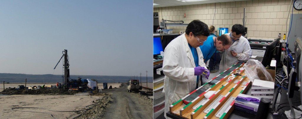
Welcome Global Partnership for Better Cities

This week, we welcomed international researchers to CURVE as part of the Global Partnership for Better Cities Conference currently wrapping up at our downtown Atlanta campus.  Faculty researchers from international urban universities including City University of Hong Kong, Hong Kong Baptist University, University of Cape Town, University of Pretoria, and University of Western Cape are convening in Atlanta this week to explore shared projects and collaborations around research on world cities and to identify strategies to move toward viable and sustainable comparative research projects.

20160327_GPBC_Conference_JB_002b
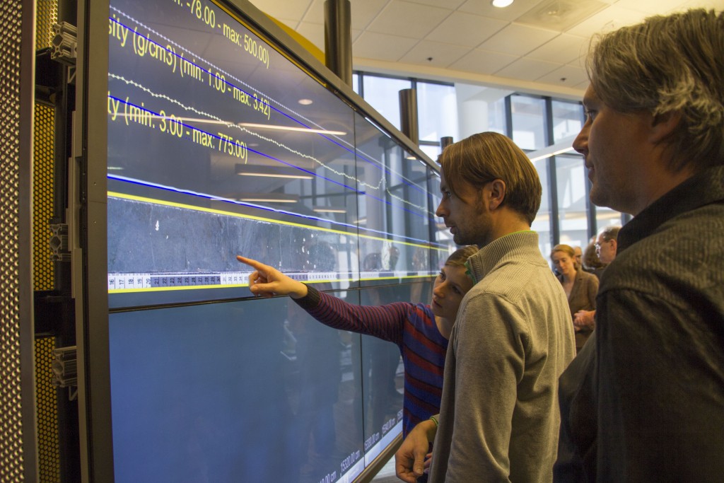
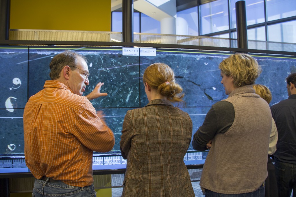
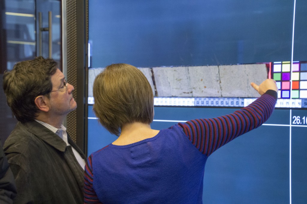
Another goal of this conference is to better understand Atlanta in an international context, including our city’s own unique history, development, infrastructure, demographics, and challenges.  As a way of sparking conversation on the opening night of the conference, Maps, GIS and Data Services Librarian Joe Hurley, M.S., Geosciences student Karlyn Harris, and Master of Heritage Preservation student David Greenberg used the visualization technology in CURVE, including the large-scale interactWall, to provide conference attendees with visual comparisons of urban development, demographic changes, and urban challenges in four cities: Atlanta, Hong Kong, Cape Town, and Pretoria/Johannesburg.
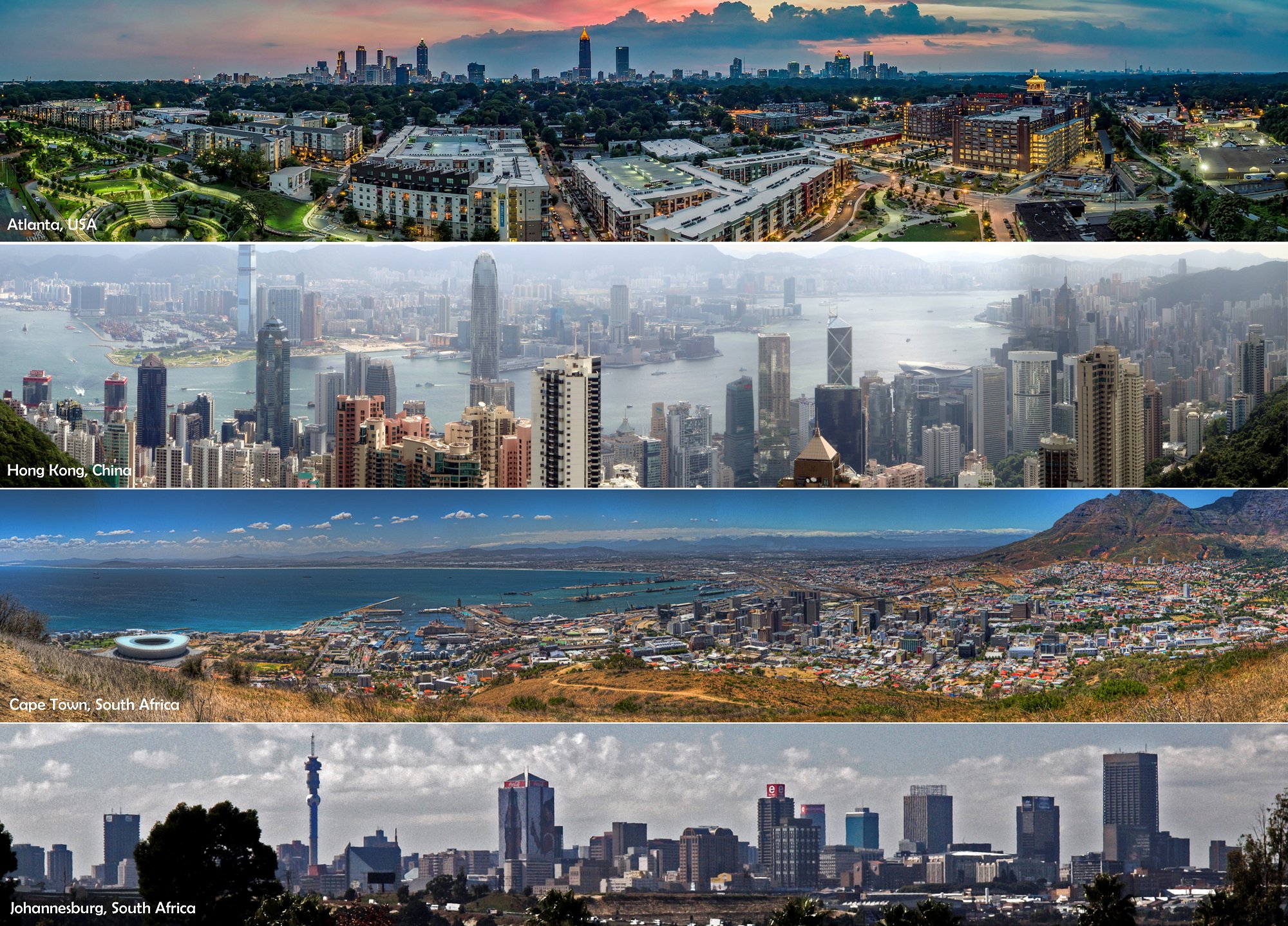
Cities_skylines_croppedbcc Photo credits: Atlanta – Richard Cawood; Hong Kong – Ben Ward In Hove; Cape Town –Pascal Parent; Johannesburg (cropped) – Photos by Damon

Smithsonian, Human Origins Researchers Use CURVE’s Visualization Technology

Georgia State University recently hosted a conference for researchers from the Hominin Sites and Paleolakes Drilling Project (HSPDP), in collaboration with the Smithsonian Institution’s Human Origins Program. The HSPDP consists of five research teams from 12 countries, plus the Smithsonian Research team that is collaborating with HSPDP.  GSU’s own Dr. Dan Deocampo directs the lab which analyzes the mineral samples from 5 of 6 core sites using X-ray diffraction techniques.

Drilling rig at Lake Magadi, Kenya, in summer, 2014 and NSF's National Lacustrine Core Facility at the University of Minnesota – Dr. Deocampo, Dr. Tim Lowenstein, and Dr. Jiuyi Wang
Drilling rig at Lake Magadi, Kenya, in summer, 2014 and NSF’s National Lacustrine Core Facility at the University of Minnesota – Dr. Deocampo, Dr. Tim Lowenstein, and Dr. Jiuyi Wang

To help visualize scanned core images, project team members worked with the CoreWall team, a group of scientific software developers who support researchers viewing images stitched together as seamless image files. With the cores ranging from 300 to 600 meters in length, visualizing these core images on a large digital canvas enhances the teams’ analytical capabilities. The 24 foot (7.3 meters wide) interactWall at Georgia State University Library’s CURVE provided the perfect digital canvas for the six research teams. Deocampo noted of the interactWall, “This technology allows us to closely examine the sediment in detail while keeping the larger context – we’re literally looking through a window at the earth’s history millions of years ago. This is helping us understand how changing climate affects the environment, ecosystems, and organisms in Africa and around the globe.” The Hominin Sites and Paleolakes Drilling Project team took full advantage of the visualization capacities of the interactWall.

Dr. Andy Cohen, Distinguished Professor of Geosciences at the University of Arizona, examines a core from Lake Turkana, Kenya.


Dr. Jenni Scott from Mt. Royal University (Canada) shows Dr. René Dommain from Smithsonian Institution and Chad Yost, Ph.D. Candidate from University of Arizona the core from Olorgesailie, Kenya.


Dr. Anders Noren from the National Lacustrine Core Facility at the University of Minnesota examines the core from Lake Baringo (Tugen Hills), Kenya.


Dr. Tim Lowenstein, from the Binghamton University, discusses the Lake Turkana core with Dr. Cat Beck from Hamilton College, and Dr. Emily Beverly, a Post-Doctoral Research Scientist in the Department of Geosciences at Georgia State University.


Emma McNulty, PhD candidate at Binghamton University, zooms in on an element of the core from Lake Magadi, Kenya.


Dr. Jenni Scott, Mt. Royal University (Canada) discusses with Dr. Rick Potts, Director of the Human Origins Program at the Smithsonian Institution, the core from Olorgesailie, Kenya, collected by the Smithsonian and Kenyan science team.


The Hominin Sites and Paleolakes Drilling Project team. GSU team members include Dr. Dan Deocampo, Chair of the Department of Geosciences, graduate students Nate Rabideaux, Alexandra Simpson, Karim Minkara, and undergraduate students David Davis and Sanam Chaudhary.

“Logics & Logistics of Qualitative Research” – Well Attended and Well Received!

Dr. Ralph LaRossa, Professor Emeritus of Sociology, and Dr. Mandy Swygart-Hobaugh, Librarian Associate Professor for Sociology, Gerontology, & Data Services, led a productive and informative workshop today in CURVE, entitled “The Logics and Logistics of Qualitative Research: A Framework for Exploring Concepts, Dimensions, and Relationships in Qualitative Data using NVivo Research Software.”

Dr. Ralph LaRossa and Dr. Mandy Swygart-Hobaugh

In this workshop, Dr. LaRossa presented the “logics” of building theoretically-rich qualitative analyses, drawing from his own and others’ publications (handout with readings). Dr. Swygart-Hobaugh then outlined the specific features of NVivo qualitative research software that complement and facilitate these types of analyses.

Interested in learning more about NVivo qualitative research software? Attend one of Dr. Swygart-Hobaugh’s regularly-offered hands-on workshops, or email her to setup an appointment to talk more about how NVivo might be useful for your qualitative research needs.

SIF Fellows Trace a History of Atlanta’s Public Transit

With MARTA expanding into Clayton County and the agency now resting on a more sound financial footing thanks to efforts by Keith Parker, MARTA appears to be on an upswing. As the concept of transit oriented development gains momentum, more areas across metro Atlanta appear open to the benefits of transit, leading some to conclude that MARTA may expand further out across the region. However, since MARTA’s 1960s inception it was planned to be a far-reaching, regional transit system. In each decade since MARTA’s beginnings, the agency proposed routes that would have made MARTA a truly expansive system. A number of these proposed MARTA routes can now be visualized in Tracing a History of Atlanta’s Public Transit, a digital project by a team of Student Innovation Fellowship (SIF) students working in the University Library’s CURVE.

This SIF team gathered MARTA proposals from the library’s Planning Atlanta collection, located information from the Georgia Power streetcar system era, and collected material about the Atlanta Streetcar and the Atlanta Beltline. By tracing each proposed route, this team turned this information into geospatial data and created Tracing a History of Atlanta’s Public Transit, which clearly shows MARTA’s far-reaching intentions. As the state and the region begin to look more favorably on transit investment, this project aims to contribute to larger discussions taking place around the topic of public transit in Atlanta.

View the full-screen version of the project here or the embedded version below.