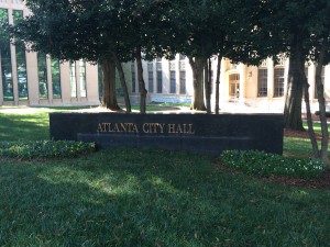
Located in front of the City Hall on Mitchell Street, this sign identifies the location with gold letters on a marble backing. Surrounded by trees and a manicured lawn, the location of this sign speaks to the image of prosperity Atlanta is committed to building in order to continue its expansion and attract profitable industries.
Built Environment Descriptions
A Monument to Advancement: Atlanta City Hall
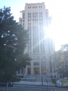
Right across the street from the Georgia State Capitol, Atlanta City Hall has undergone a transformation. The addition of trees and green space surrounding the City Hall is not the only change the city of Atlanta has undergone since the government building opened in 1930. In 1989, a new annex was added to the building as well. As is, the structure,
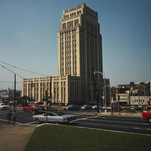
located on Mitchell Street, “looks like a city hall,” as noted by one of my fellow observers. The adjacent blocks are dominated by government buildings and historic churches, many of which have played major roles in shaping the built environment over the decades.
The third and longest occupied of Atlanta’s city halls, the current city hall was built as a monument to advancement as Atlanta settled into its role as the hub of business and commerce of the South. Today it houses meetings, offices, and public services. The outside is almost serene in its beauty with statues and lush grass, and the block is quiet during the afternoon. Across the street, a couple of students hang are standing in front of the pizza restaurant, and a few homeless people sit on the stone wall beside Trinity United Methodist Church, an organization that was a key player in the development of the area. Th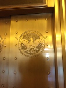 e inside is equally quiet. As I chatted with a security guard about obtaining permission to take
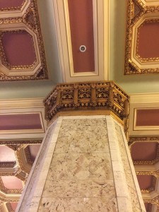 photos, I was astounded by the elegance of the lobby. Ornate pillars held up the gilded ceilings and images of phoenixes, the symbol of Atlanta, emblazoned every appropriate surface. In 1966, Mayor Ivan Allen Jr. brought both national football and baseball teams to Atlanta, and the lobby showcases the first two game balls from each sport. Their display is a symbol of the economic prosperity introduced by one of Atlanta’s most popular and well-known mayors.
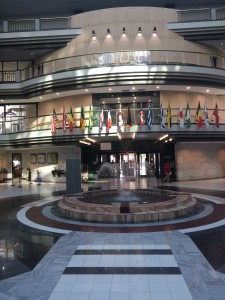
Shorty after the addition of the annex in 1989, the need for more parking for additional employees sparked some controversy. For economic reason, the City of Atlanta wanted to hire private developers to construct parking garages over the two existing parking lots and install mixed income housing developments in the area surrounding City Hall. Central Atlanta Progress (CAP), a downtown civic group, protested. I observed a handful of parallel parking spaces in front of the building, and an apartment complex across the street, along with the pizza restaurant and a few other businesses. There appears to have been a compromise between the two proposals for parking–one still exists while the other was converted into retail space and apartments. This area, like Atlanta, is constantly developing in order to maximize economic benefit, and City Hall is undoubtedly the hub of all such decisions.
Fairlie-Poplar: The Fireproof District
If you’ve ever made the trek to Aderhold, you might have stumbled upon a gem without even realizing it. Nestled into the northwestern edge of Georgia State’s campus, were it not for the eclectic signs proclaiming, “Fairlie-Poplar Historic District,” I might have overlooked it myself. Once lauded as Atlanta’s “fire-proof” business district, the area is densely populated with historic office buildings and is the site of many former hotels. It is located between the Peachtree Center and Five Points Marta stations, making the former business hub extremely accessible by public transportation. On an autumn day, the district hums with a gentle sort of life as the wind sweeps past re-purposed buildings, offices, and restaurants.
Although the border is contested, the district is officially bounded by Peachtree, Luckie, Cone, and Marietta Streets, but stretches a bit further in each cardinal direction. The internal streets include Fairlie, Poplar, Walton, and Broad Streets.
Once a hub of business and commerce, the district has condominiums for rent, several restaurants, and even Georgia State classroom buildings. The area is a seamless blend of old and new–a number of old buildings have been adapted for reuse, including the Flat Iron building, one of the first “skyscrapers” in the city of Atlanta. The construction of buildings like these signaled a shift in construction. Instead of wood, the buildings were made of steel and concrete, making them “fireproof.” Although very strong, many were skeptical of the new building material. In an attempt to reassure businesses and encourage them to use new office spaces, features with no use, like steel “reinforcement” beams were added to buildings, and remnants of these can be seen around Fairlie-Poplar. The Helen Aderhold Learning Center, one of Georgia State’s classroom buildings, although constructed in the 2000s, is located across from the Flat Iron Building and imitates the concrete and steel style of the surrounding buildings, blending in with ease.
The streets, constructed for foot and horse drawn carriage traffic, are narrow. While I was walking, I encountered such traffic in front of the Healey building, a lovely office building that has since been re-purposed as condominiums.
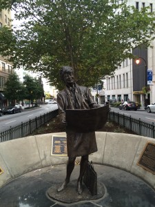
The district is also home to a number of memorials for city figures, such as Henry Grady, whose statue sits in the middle of the Marietta Street Island, Margret Mitchel, whose dedicated square sits just outside the official boundary of the district, and Barbara Asher, who also has a statue and square dedicated to her. It is clear Fairlie-Poplar has made an effort to maintain city culture. Outside the Candler Building at the corner of Peachtree and Williams Streets, I witnessed a protest, which, in my opinion, is a testament to the lively cultural diversity of both Atlanta and this district.
Candler Building Protest
https://www.youtube.com/watch?v=qw96cQUwW2c
This protest took place on October 15, 2016 in front of the Candler Building and continued down Peachtree Street. In a call and response style, the protesters are shouting, “What do we want?” “Justice!” “When do we want it?” “Now!”
Healey Building
The Healey Building is located at 57 Forsyth Street and features neo-gothic pillars at the stone front of the building. As observed, a horse drawn carriage pulled past the front of the building. Although not featured, the atrium of this building is grand and elaborate in its construction. Originally an office space, the building has been converted into condos. The downstairs offices remain, but they are nearly all empty, as are the retail spaces. The building is quiet, save for the adjoining coffee shop, and were it located anywhere other than the Fairlie-Poplar District, both its interior and exterior beauty would be unbeatable.
Fairlie-Poplar Signs
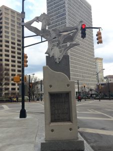
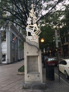
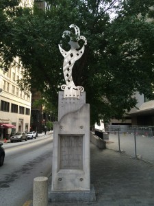
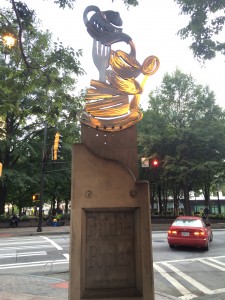
Made of what appears to be metal and concrete, these Fairlie-Poplar signs are scattered about the district and feature what I can only assume to be characteristics or attractions of the area. Although I looked around for corresponding businesses or buildings, I didn’t find anything that matched the signs. I inferred that the tea set represented dining and restaurants, the jester entertainment, and the violins music, all of which can be found in some form in the Fairlie-Poplar District.
Barbara Asher Square
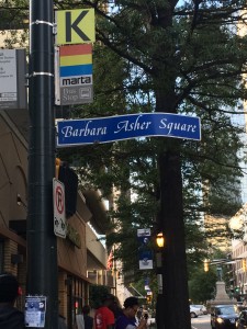
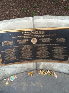
Barbara Asher Square is located off Marietta Street and directly behind the Five Points Marta station and is at the edge of what I defined as the Fairlie-Poplar District. The area, which feeds into the main part of Fairlie-Poplar, was bustling, aided by the business of a couple of street kiosks and McDonald’s on the corner and those exiting the train station. The statue of Barbara Asher, a prominent Atlanta figure who is responsible for the zoning of Fairlie-Poplar, is located on a strip of the Marietta greenway.
Henry Grady Statue at the Marietta Street Island
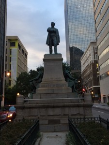
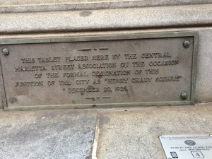
The Marietta Street Island is a strip of greenspace that runs along, you guessed it, Marietta Street. It serves as a median between the two sides of the busy street. It’s a little bit surreal to stand in the middle of Atlanta traffic, in the middle of the road, no less. The Henry Grady statue, is near the intersection of Forsyth and Marietta and designates the junction “Henry Grady Square.” The statue, as stated by the plaque, has been there since late 1929.
This Google Street View provides a full shot of the area.
Pipe Corner Sign
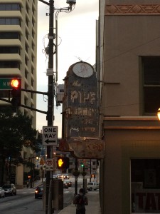
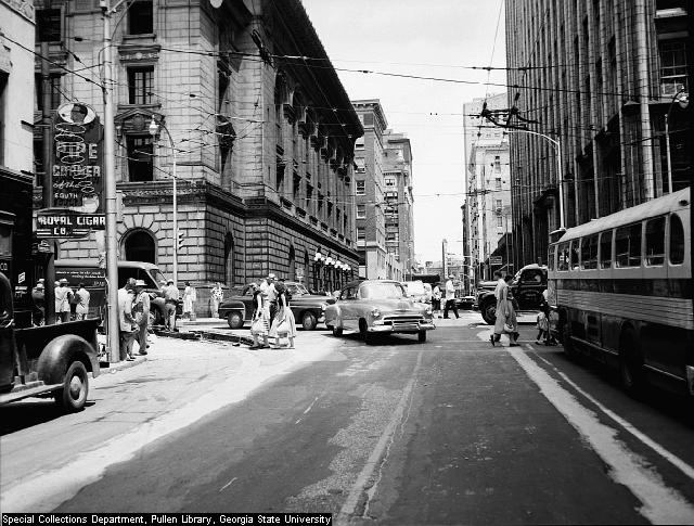
This antique sign, which faintly reads “pipe corner” is located at the corner of Walton and Forsyth Streets and is attached to the Forsyth-Walton building, where the Executive Shop is located, as well as a tattoo parlor. The image of above is of the same street corner (taken from a different angle) in 1952. From this picture, we can now see that the sign once said “Royal Cigar Co.” and above it “The Pipe Corner of the South.”
(Click the images to enlarge)
U.S. Mail Chute
Thi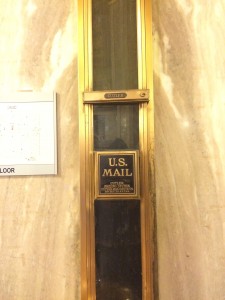 s U.S. mail chute is located inside the City Hall next to the elevator bank. Clearly part of a larger system, its ends disappear into the the ceiling and the floor. This door to the chute didn’t open, but there must be one on a higher floor that does, since there was trash stuck in it. I thought this was noteworthy because this is the second chute I’ve seen in my BED observations. The first was in the atrium o the Healey Building, again directly next to the elevator bank.
